Mines of Spain Dubuque
 Trails note- Trails in the Mines of Spain can be affected by water depths of the Mississippi River. Catfish Creek which runs through the park consists of back waters of the river and its depth varies with the rivers depth. Please check water depths of the river by going to River Gages Website Flood stage in Dubuque is 17 feet. The portions of the Calcite Trail and Mesquakie Trail are affected when the river stage is at 15 feet. The Catfish Creek Trail will be affected when the depth rises to 18 feet. Flooding of the trails usually occurs in May. Please check the Corp of Engineers flood data or call the park office for updates.”
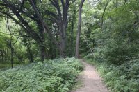
1. Catfish – 2 miles: This trail covers a wide range of area. The lower portions find its way along Catfish Creek which gives the trail its name. The upper portion goes past rock out-croppings, through white Birch and River Birch forested areas. A savanna area on the east end includes Indian Mounds and 200+-year-old Oak trees.
2. Calcite – 2 miles: This trail is named for the common rock found in the park, Calcite. A large sample is at the trailhead in the parks main picnic area. While on the trail watch for bowl shaped holes in the ground – lead mine pits. This trail is steep at the start by the main picnic area.
3. Julien Dubuque – ¼ mile With access from the parking lot, this level sidewalk trail leads to Julien Dubuque’s Monument which is a National Historic Landmark. This handicap accessible area features a scenic overlook and benches and picnic tables.
Julien Dubuque Foot Trail. A new portion of trail has been completed at the Julien Dubuque Monument. The trail starts at the picnic area and winds down to the north into Riprow Valley. The trail dead ends at the bottom and eventually will be connected to a parking area and will serve as a trail head for Heritage Trail which runs north through the city of Dubuque and then west to Dyersville..
The trail is about 1/4 mile long. It is an extension to the Julien Dubuque trail that goes south down to Catfish Creek.
4. Horseshoe Bluff Nature Trail – ¾ miles Accessible from the main park road, this trail features a scenic overlook at the north end. From here you can see the Julien Dubuque monument to the north and view the old quarry to the south with the Mississippi River in the background. Interpretive signs explain the parks geological history. You can enter the quarry from the south going past the wetland.
5. Cattesse – 1 ½ miles: The trail means Catfish East Southeast. The trail flat and goes up through a major valley cutting the park in half. Spring, fall and winter allow you to see and explore the rock out croppings, some 70 feet high. In the summer the trail has dense foliage prohibiting you from seeing the rocks.
6. Nature Center Trails – 1 ½ miles. Trails lead from the E.B. Lyons Interpretive Center and Park office. Junkerman Trail includes remnants of an 1859 farm area including: a hillside lane, meadow, farm garden area, natural prairie, pine chapel, grapevine terraces, farm site, herb garden, root cellar, chimney rock and creek overlook, wine cellar, meadow trail, bridge, greenhouse, table bluff, surface lead mine, shaft lead mine, and ravine
7. Mesquakie Trail – 1 mile: This trail connects the E.B. Lyons Center with the rest of the Mines of Spain. Access is from the northeast corner of the Nature Center Trails. This trail will take you across Granger Creek and along Catfish Creek on its south side. It will eventually hook-up with the Calcite Trail.
8. Prairie Ridge Trail – 2 miles: This trail has been designed for cross-country skiing and for hiking. The trail passes through tall grass prairie that has been planted in sections from 1994 to 2001.
9. Cedar Ridge Trail- 1 ½ miles: This trail has been designed for cross-country skiing and hiking. The trail passes through areas that were planted with Red Cedar trees during the 1980’s.
10. Eagle Scout Trail – 3 ½ miles. This trail starts at an intersection on the Cedar Ridge Trail. It winds down and connects with the Cattesse trail where it continues to the extreme south end of the park. The trail has been built by Boy Scouts earning their Eagle Scout award. This trail is long, winding through forests, prairie and cropland. You probably will not see other hikers, as this is a remote area in the south end of the park.
Source: www.minesofspain.org
norwich terrier for sale : Isola Dei Tesori
Related posts: